Espoo all powdery white and Skiexpo just finished, it is due time to start shifting focus to the winter. And what better way to get that started, than looking back at the last season’s ventures, for buzz and inspiration.
Season 2015/2016 was extremely good for me, right from the very start. Opening the season already early December, in Ruka, joining a 3-day telemark boot camp organized specifically for our small group, was the perfect kick off. It was facilitated by Ruka Ski School, with Martti Kontula as the instructor. Lucky with the weather, we even got some fresh powder, and the boot camp was both humbling and educational. Videos shot during the camp were ruthless in their honesty, but were a great way to highlight and discuss improvement areas in one’s form and technique. Tips, ideas and both physical and mental exercises were shared, to carry the teachings through the season.
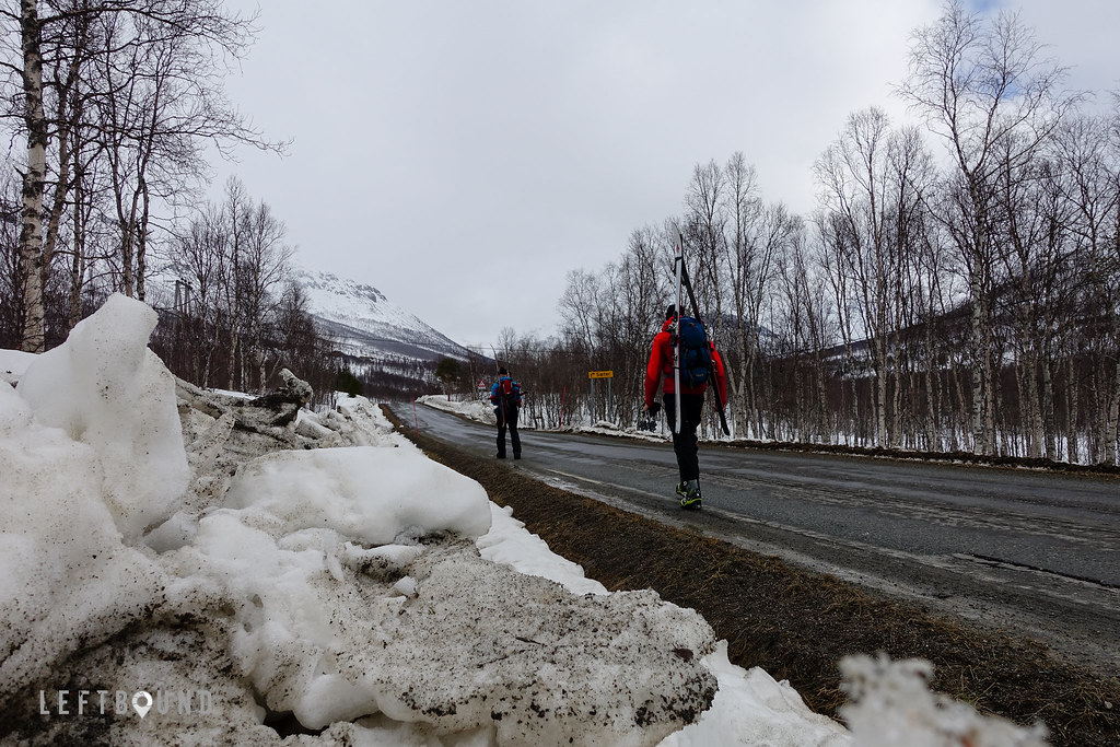
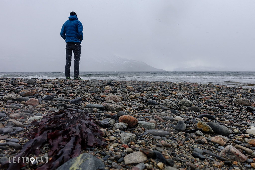
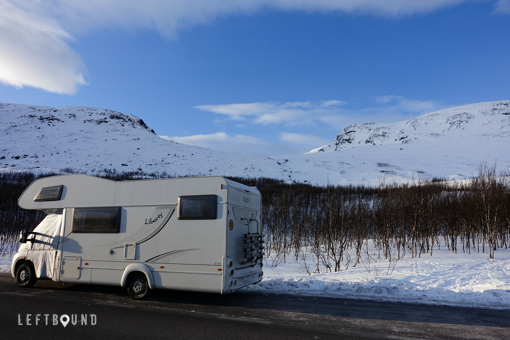
Plenty of turns followed that great start, with one of the memorable adventures being a road trip to the Lyngen alps, and Northern Sweden, in early April. Not a stranger to the mountains of Norway, having done summer tour in the glaciers near Lyngseidet, climbed rock in the magic islands of Lofoten and ice in Rjukan, I have for long wanted to explore also the ski touring possibilities around the fjords of Norway. So when an opportunity came to plan and execute a road trip in those surroundings, on a camper, no second thoughts were given.
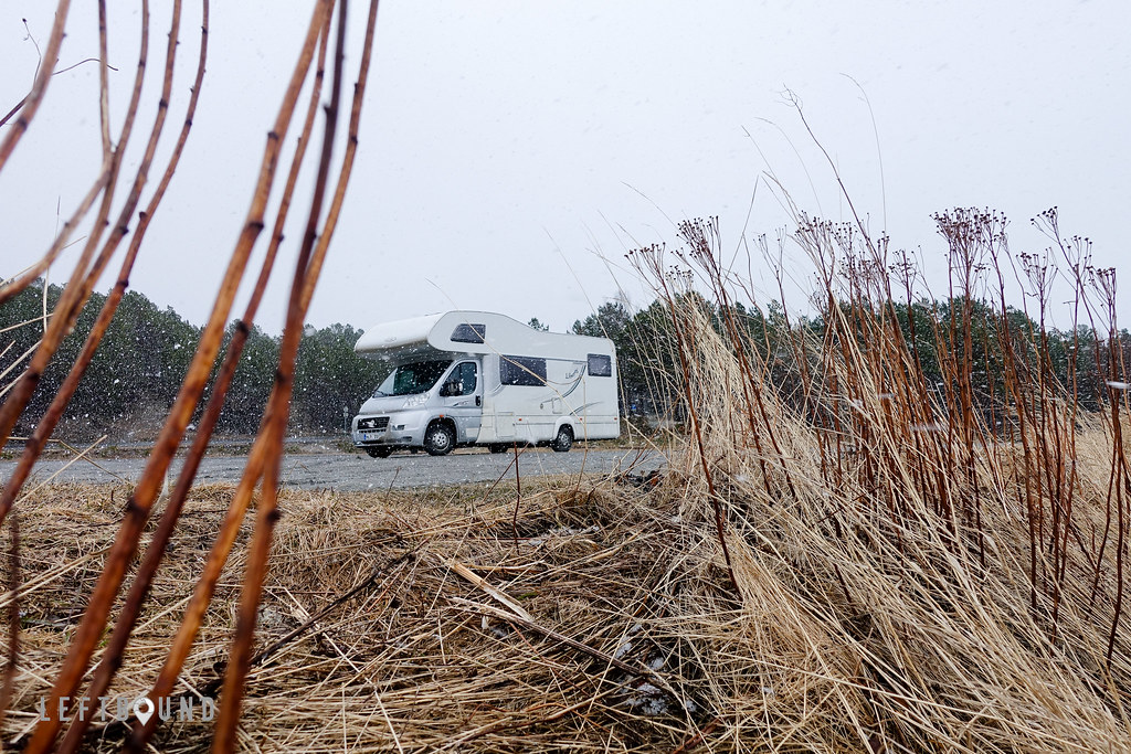
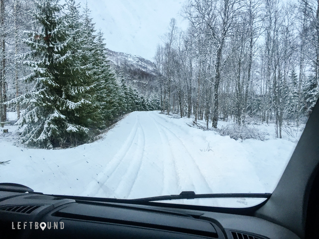
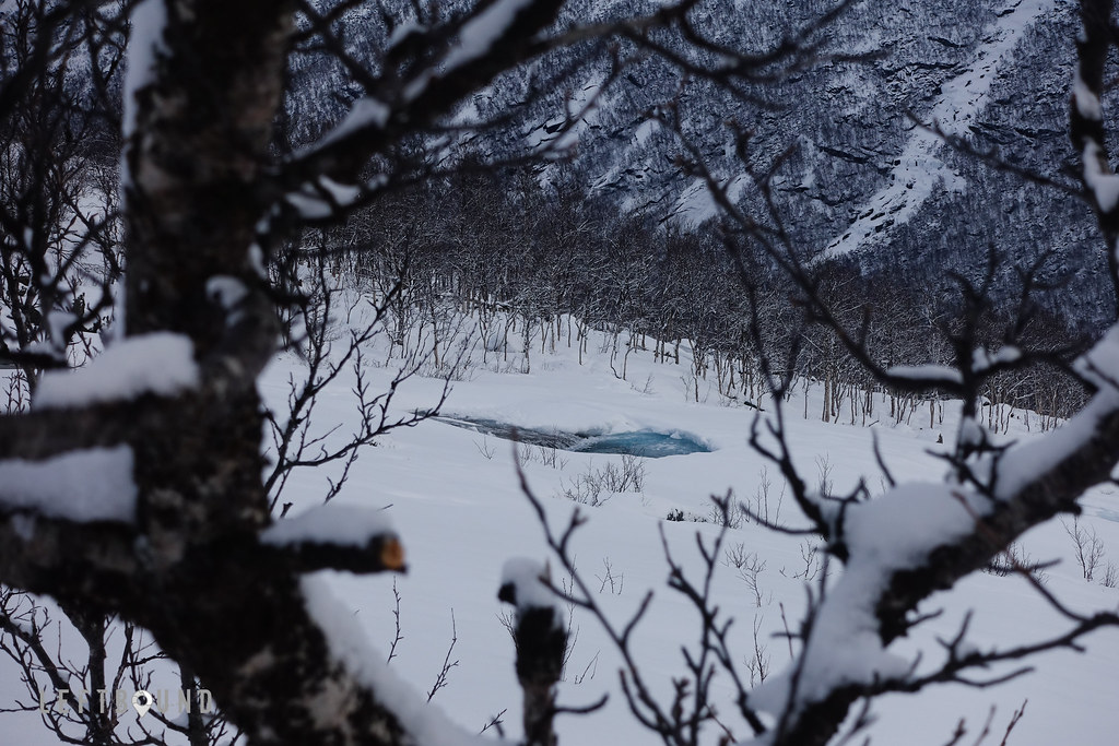
It’s a long way across the country, in total some 1400 kilometers from Espoo to the Tamok valley in Balsfjord, which was the first destination on our loosely planned tour. A great location for ski touring, the 25 kilometer long valley has everything from wide open lines on mellow slopes to steep walls and gnarly chutes. We parked the camper at the ‘Huset’, a legendary basecamp at the foot of mountains, ran by Aadne Olsrud. An old community hall resurrected, it has all the basic amenities to relax and recover after a day in the mountains. While we slept and cooked in the camper, we paid a small fee to use the facilities while there. Evening of arrival was spent over a map and a guidebook, planning, with a keen eye on the weather forecast which wasn’t very promising for the next few days.
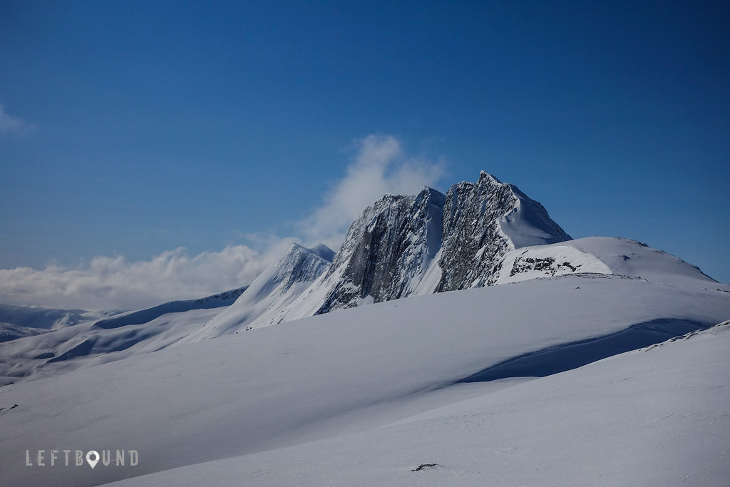
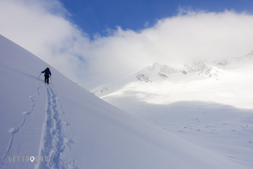
Our chosen tour took us next morning to Sjufjellet, a classic peak in the area. Despite the special micro climate which typically makes Tamok more snow-sure than the surrounding valleys, at this time snow was relatively scarse at the valley, but we hoped to find a good run higher up regardless. Skinning up, we transitioned from wet slush into a hardpack, reaching the soft stuff some one thirds up on the face of the Seven. Despite the overcast and clouds hanging low, the visibility remained good on the way up, with a perfectly timed opening in the sky, when we reached the summit after some 900 meters of vertical climbing. Enjoying the views around us, we took a short break. Weather starting to close in again, we headed downhill, and had a great powder run on the upper slopes, cruising down. Visibility remaining good, as we tracked back the short traverse and descended back to the valley. A great first run for the trip!
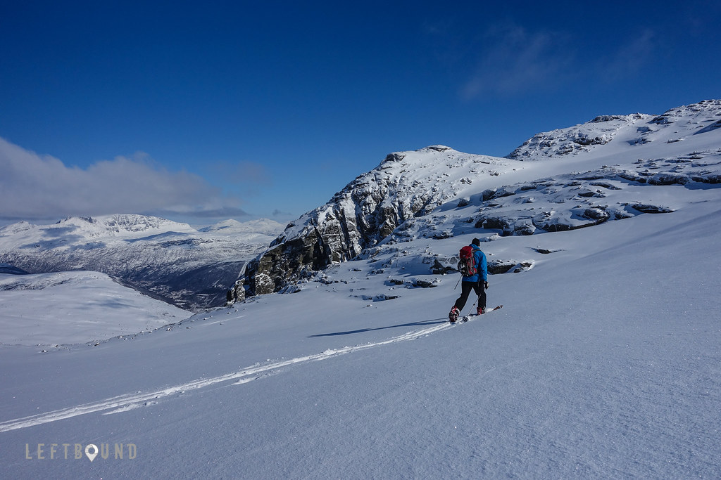
We stayed for another night, but unfortunately the weather was closing in on us, and we decided to hit the road again next morning, after consulting few maps, guidebooks and yr.no. Northbound again, we drove to Lyngseidet. Arriving there early afternoon, weather was indeed looking a lot better, with a much lighter overcast with few openings in the horizon. Plenty of day left, we decided to take a shot at summiting Kavrintinden, to ski down a steep bowl just below the summit, and cruise down back to the town. Tour started right above Lyngseidet, and followed a well-trodden path through the woods, bringing us without on to the higher, more open terrain. On the way up we awed the surrounding mountains and the fjord down behind us.
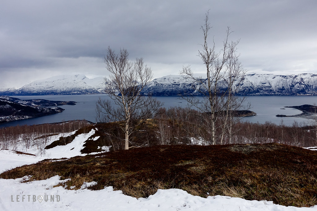
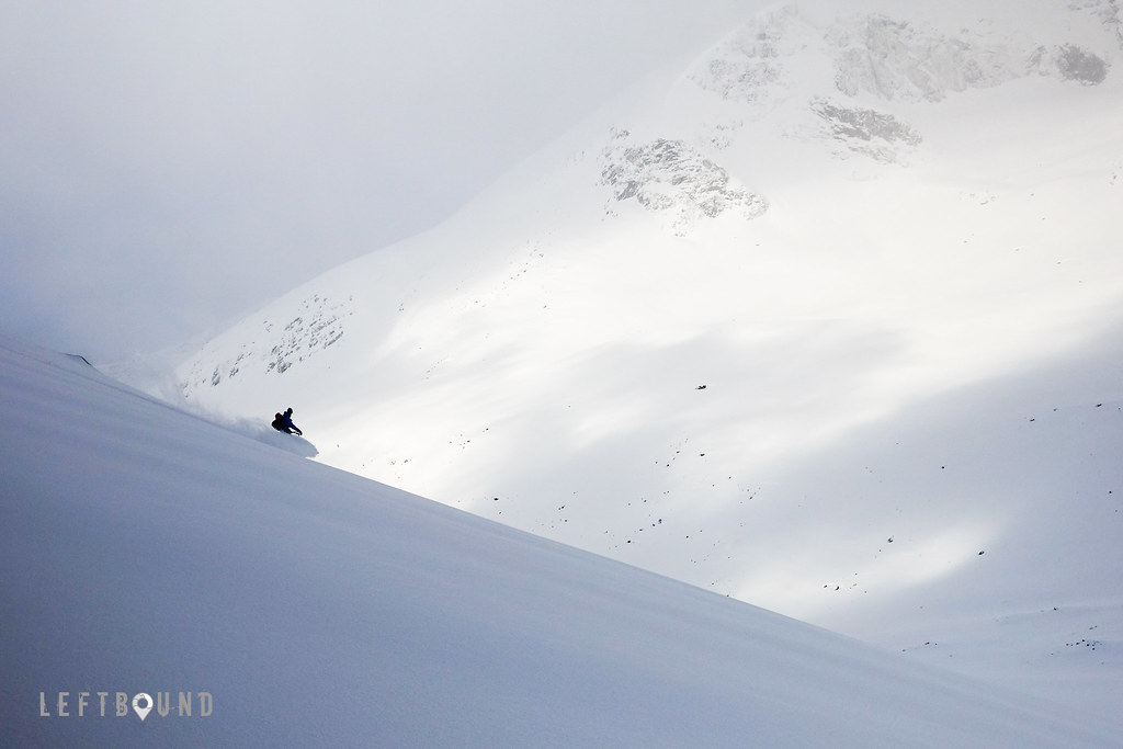
Higher up, it got quite steep, and at times, especially on wind-packed snow, I was pushing the limits of my climbing skins, not having a pair of ski crampons (none exists for my NTN bindings). On the soft stuff, things were naturally a whole lot easier. Snowpack was stable, and we could continue at ease, finally reaching the summit ridge. Entering the ridge after some 1300 meters of climbing, the wind blowing from the other side caught us, so we hurried across it, and took shelter just below the summit. We decided to skip hiking the last 5 minutes to the summit above, but instead took a short break and watched the weather miracly starting to clear out completely. Dropping into the bowl, a clumpy ride at first, exiting the steepest section it was pure joy on the way down. We carved turns in untouched powder snow, sun on our backs, unfrozen fjord underneath us. It’s only in places like Lyngen, where you get this kind of spectacular views no camera can truly capture.
While we got lucky with the weather window, it did not hold for long, and so we decided to move on again, this time towards Narvik. Next day, we were considering skiing in the Narvik fell for half a day or so, upon arrival, but since the visibility higher up was bad, there was no point. So we enjoyed a day off and while stocking up supplies, we again hunched over a map and decided to head over to a valley south from Beisfjord.
Driving there on a meandering backroad, it started to snow heavily, and in couple of hours, there were some 20 centimeters of fresh snow accumulated. We camped near a beautiful valley lake with a high mountain skyline all around.
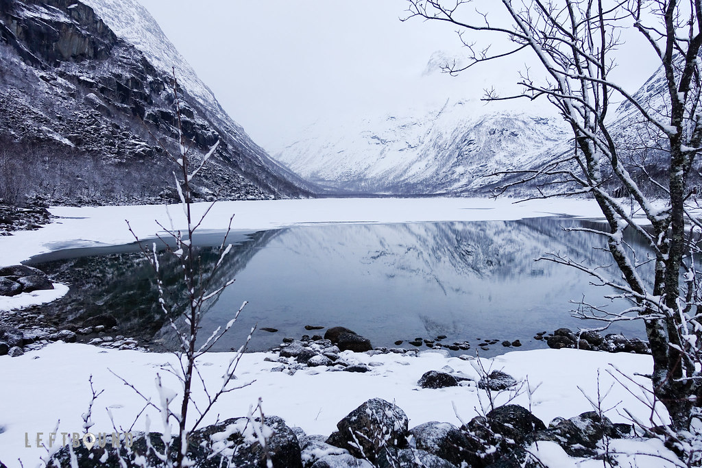
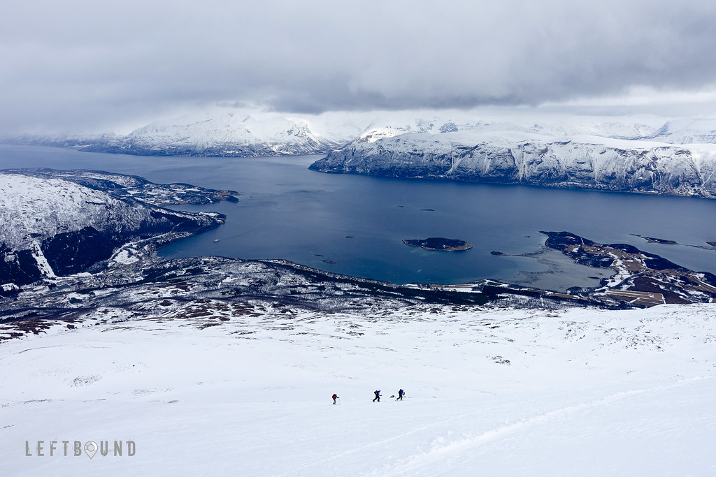
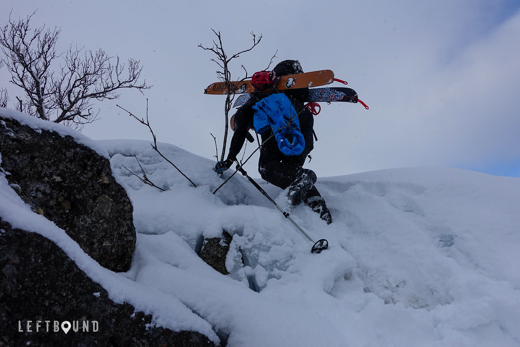
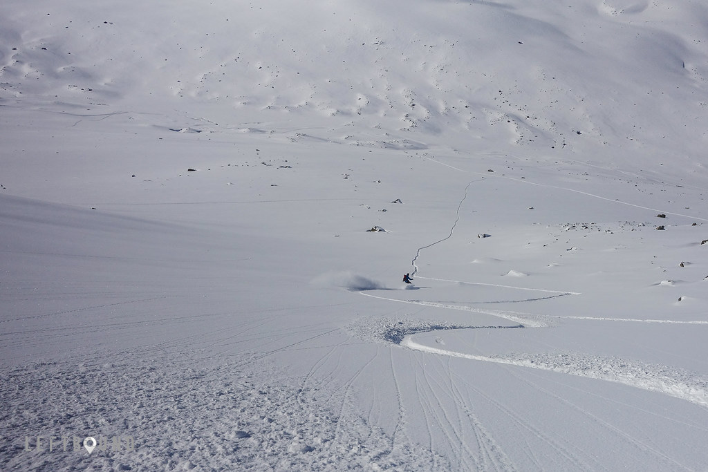
Next morning, again with an overcast, we started our tour from the valley, heading towards Tverrdalsfjellet and Máttačorru. First hour or so we had the skis on our backs, scrambling up a steep rock garden, following a now mostly hidden stream running down from the mountains. Reaching the treeline, and the valley higher up, weather again started to clear up. Sun shone on us sporadically, while we continued to skin up. Once we reached the gulley we had planned to explore, we soon had our skis on our backs again, as we inched up the steep gully, closely monitoring the snowpack for any instability. Due to the fresh snowfall, there was a good amount of fluffy snow on top of a harder layer of old snow, well compacted. Examining the snowpack, we found no alarming weak layers that could potentially fail when loaded.
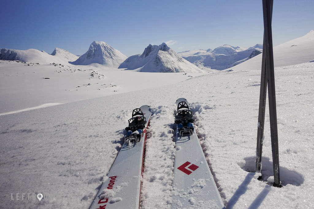
Reaching the top of the gulley, we were met by astounding views all around. Skies having completely cleared up on our climb up, with no wind to speak off, we were in no hurry to head back, but instead spent few hours touring the upper range and checking the Máttačorru traverse that would have been interesting, had we brought some climbing equipment with us. We skinned up and skied down smaller contours, and basked in the sun. We couldn’t believe how lucky we again had gotten with the weather window. Forecast had indicated weather could clear a bit towards the afternoon, but to our pleasant surprise, it turned into a blue bird!
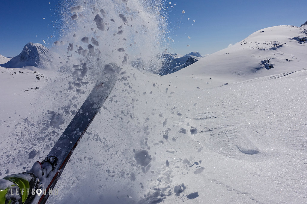
When it was time to head back down, after a total of 1500 meters of climbing, we found ourselves cruising down the steep gulley, enjoying the perfect soft snow. Apart from a few shouts of awe and joy on the way down, all sounds were muffled by the layer of fresh powder.
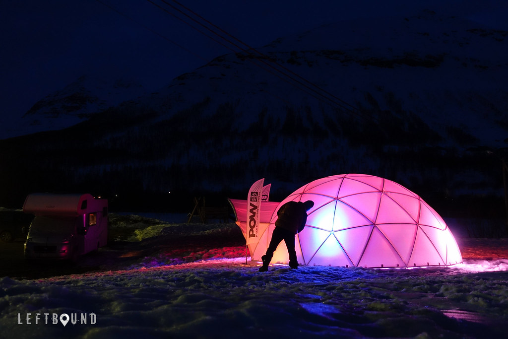
A great tour under the belt, but weather closing in on us again (you see a pattern here already?), we moved on again and left Norway, barely. Our next stop was at Riksgränsen, a ski resort just on the border of Sweden and Norway. It was only few weeks I had been there last time (more about that trip later in this blog), ski touring, but this time it served as a place to recover and resupply for a day. I also did some kite skiing, as I had brought the gear with me, should an opportunity like this arise. Weather remained reasonable throughout the day, though windy (hence the kite) and overcast.
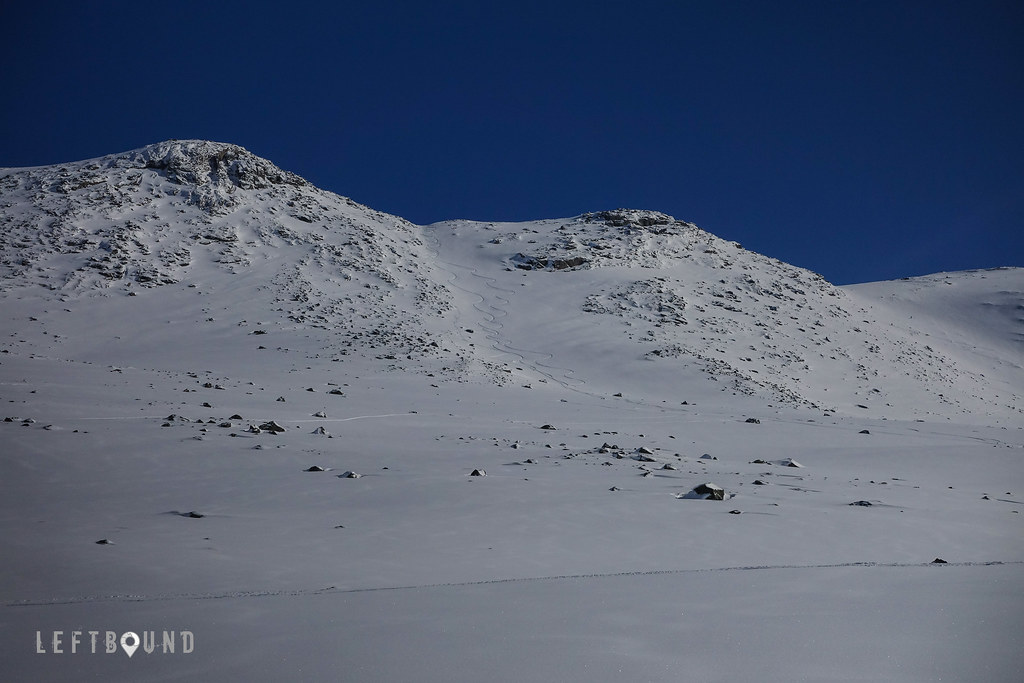
Our next, and the road trip’s final tour was decided to be in the vicinity of Låktatjåkka. Parking overnight on the side of the road, on a narrow turnout, ensured an early start straight from the camper.
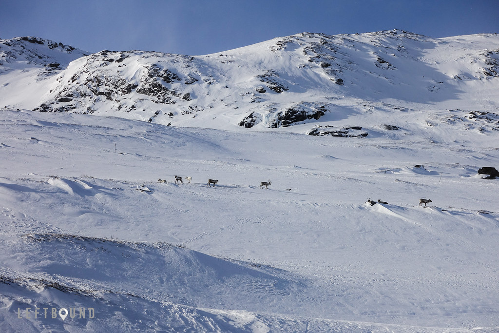
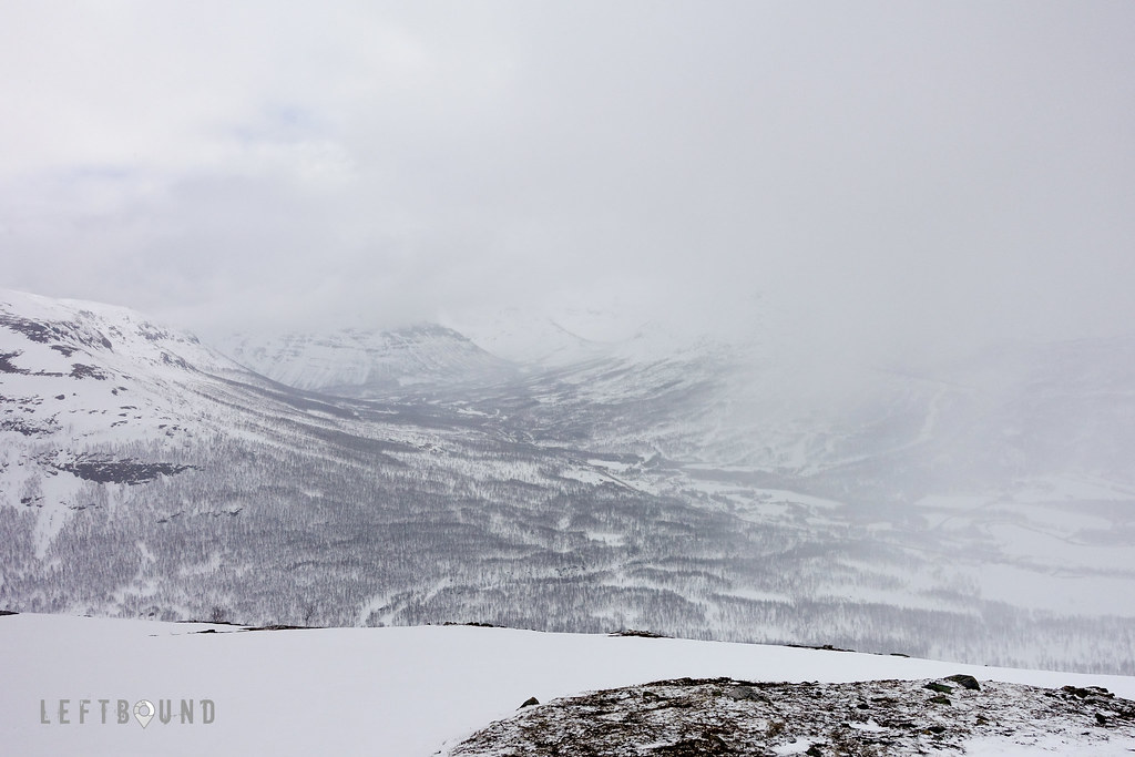
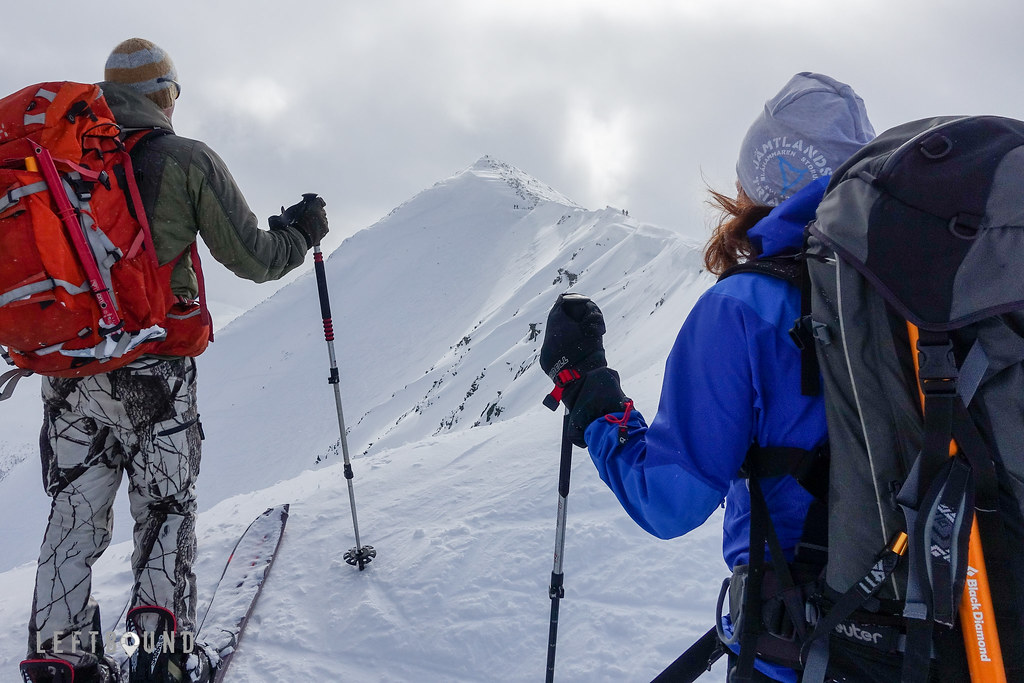
Mother nature agreed once more, and soon after we had started our way up next morning, we were again greeted the sun, peeping behind the quickly dissipating clouds. Skinning up we took note of areas with soft powder, and saw a herd of reindeers on the lower slopes, passing them from a distance. Once we were up in the valley, through which one also travels to the Låktatjåkkastugan (a mountain hut that can serve as a basecamp for ski touring in the area), we took a right turn, and started climbing up a saddle that would lead us towards Geargecorru summit. Snow was partially wind packed, with soft spots in more sheltered zones, before we reached the top plateau. Completely wind blown and icy, with lots of rocks visible, we gave up on the idea of summiting as pointless, perhaps 200 vertical meters before the summit, and instead continued down south to explore the leeside slopes for some powder turns.
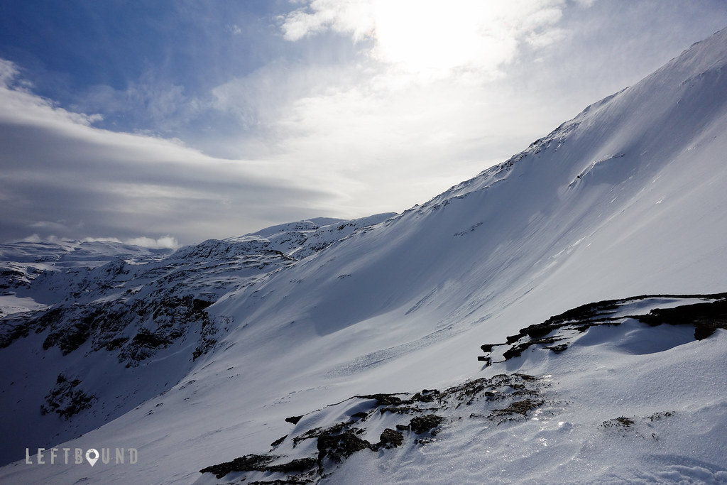
Not surprisingly, the snow was much better on that side, and we had good runs with plenty of soft powder. We saw some traces of avalanches on some of the steep walls nearby and carefully kept on evaluating the conditions for safe skiing. Guidebook we used had warned about hazardous exits from the summit plateau, should one wish to ski down one of the steep couloirs that connect to the valley between the mountains. Despite our careful map reading and good visibility, approach to what we thought was the correct chute, from above over a convex slope, met a dead end. A large drop down below and icy traverse on both sides, had us climbing straight up, skis on our backs. Taking note of the surprisingly icy conditions on that part of the mountain, instead of traversing a bit further, we decided we would be better off taking the long cruise back, following our ascent route from the valley. A smart choice in the end, it was a nice run back to the camper in mixed snow of powder, hard pack and crud.
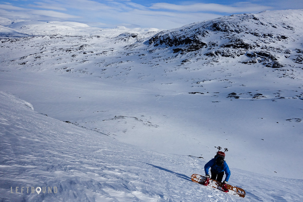
All good things come to an end, and thrilled about how things had turned out throughout the week, we started the long journey back home. As we had had to make and change plans on the fly, judging the weather and the prevailing conditions in the mountains as we went, having a camper with us turned out to be a trip saver. Being able to move with (or run from) the weather allowed us to take the most out of what nature chose to offer. I can highly recommend a similar tour, and a camper as the moving basecamp. For this trip, there were just two of us, and despite I’ve referred to only ‘skiing’ above (for simplicity), my friend was actually on snowboard, a splitted one, as you can see from the pictures. This worked well, as skinning up we had a similar brisk pace and a team of two keeps thing simple, yet safe enough. Splitboard seemed to work fine for most part, though steep traverses on short but wide halves was definitely more strenuous, especially on hard pack. Of course snowboard is superbly good on powder, so for the extra effort, there is a reward in the end. I use telemark skis myself, NTN’s (Rottefella Freedom) and medium width, lightweight skis (Black Diamond Carbon Aspect), that worked perfectly throughout the season.
As I’ve mentioned, we used maps and guidebooks to make plans on the go. Depending where in northern Norway or Sweden you head to, you might find the following guidebooks useful:
- Ski Touring in Troms
- Toppturer i Norge
- Topptur Narvik-Riksgränsen-Björkliden-Abisko (discontinued, but a great book if you can find one)
Also few web resources, such as Kugo.no and Snösäker.se, are extremely useful for planning purposes.
❯❯ Flickr album (with more photos): Road Trip in the North